Reflections

Reflections

Thursday, December 23, 2010

Snow, Need I say more?

Last week I took my first Snowshoe trip on the slopes of Mt Shasta. I had decided prior to the snow falling that this winter I was going to invest my Snow time on Shasta instead of Lassen. It was a wise decision.
Mount Shasta from the South West at the Bunny Flat parking lot


 For those of you that are not familiar with Mt Shasta it is the predominate physical and geological feature in the north state. Reaching 14.162ft into the blue skies of Northern California it is majestic and awe inspiring.
Mt Shasta from Mc Cloud
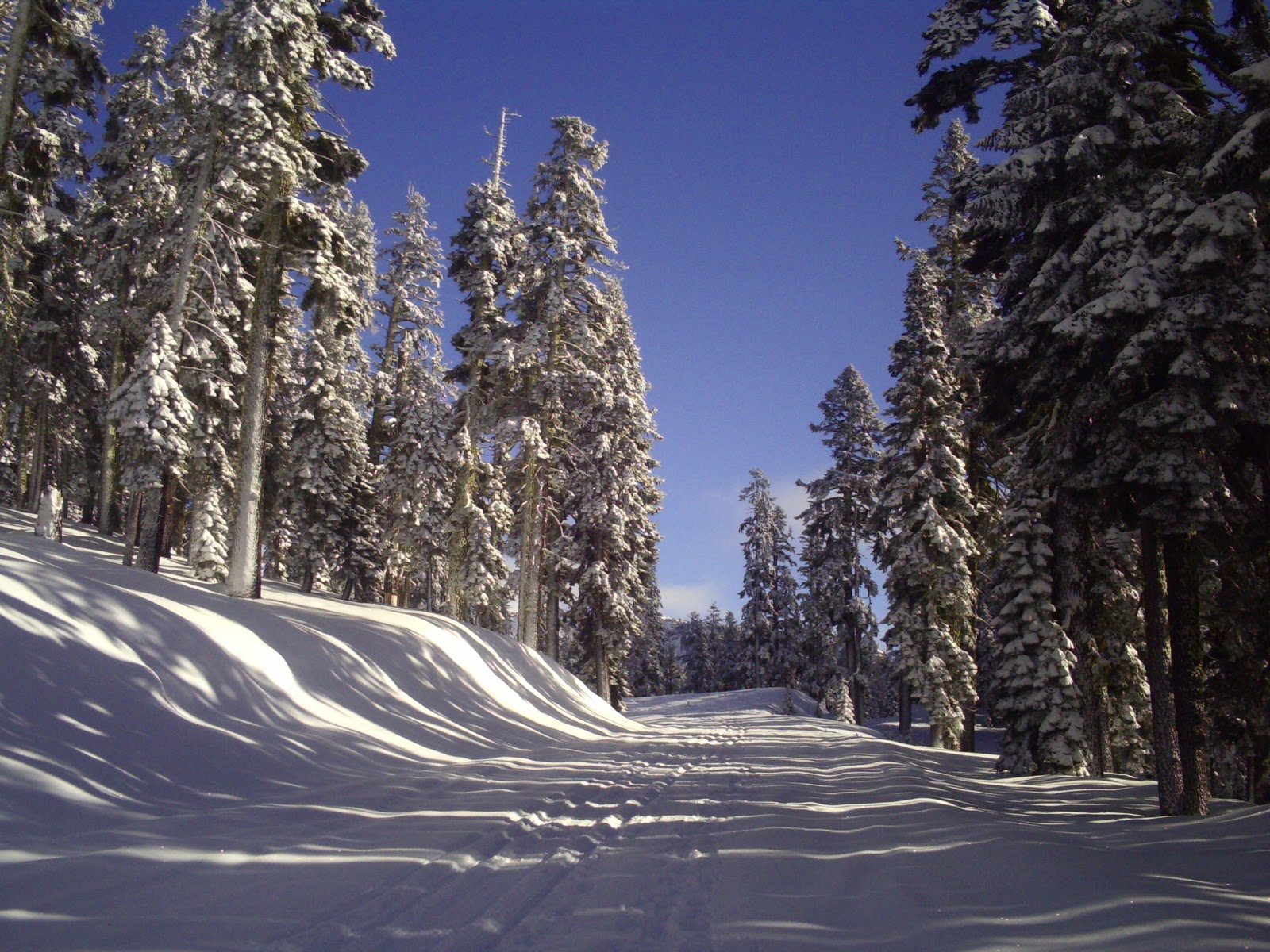
I started my trip at the Bunny Flat parking lot. This is a common starting point for numerous destinations on the mountain including one of the most popular routes to the top of the mountain Avalanche Gulch. It is also the end of the plowing on the road that leads to the old ski bowl which was the route I had decided on. The weather was perfect. I managed to schedule my trip between two large storm systems and as you can see in the pictures the trees are still coated in snow from the last storm.
Bunny Flat Parking lot

As I mentioned above the weather was perfect

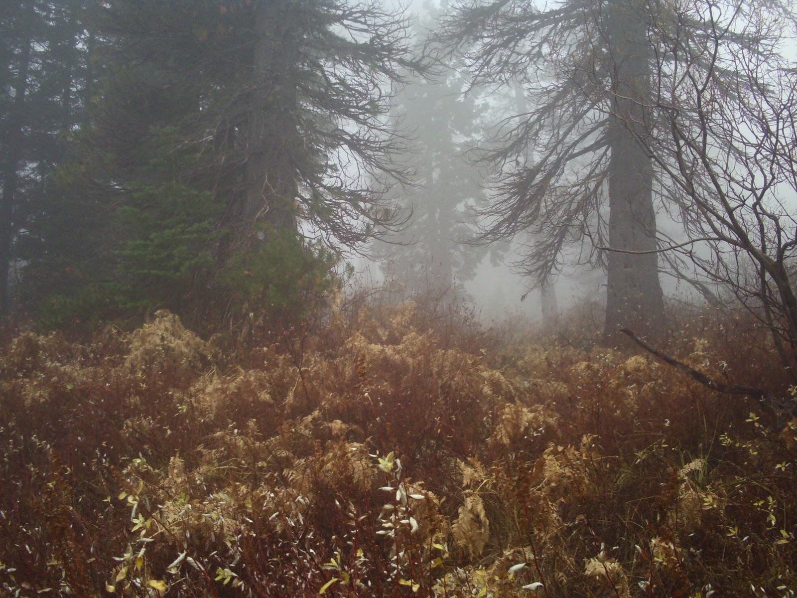
The route I took followed the road along the south slope of Shasta. On the way in most of the valley was shrouded in clouds as was the mountain. The snow covered trees and the unusual ice formations on some of them was more than enough to keep me occupied.
Soon after heading out the clouds moved in shrouding the mountain and only giving me an occasional glimpse of Shasta

This was a very cool. The tree is coated with ice.

For some reason the ice gives the tree an out of focus look. It is a very odd effect.
The road runs relatively straight until it takes a hard left turn and heads up to the old ski bowl. Just prior to the turn I crossed an old avalanche run-out. I don't know how old it is but it was a big one. 
Looking South. You can see the end of the run out where the tree line begins.

West edge looking North

Up the middle. As you can see not much was left behind
My destination was Gray Butte which is East of the road. To reach it I needed to leave the road and head off cross country. There is a camp ground at the turn I mentioned previously and that is where I started the cross country portion of my trek. There was not much visible to indicate I was traveling through a camp ground until I came upon the bathrooms.

This view gives a good perspective on the snow depth

Since I took this picture 4-5' of snow have fallen.
From here I headed out to Gray Butte. The forest here is very dense and the terrain is very uneven. Picking my path was an adventure, especially because I had never traveled this route before. Gray Butte provided an easy landmark and an exquisite view as I headed east.
This is a sample of the type of terrain I traveled through.

As I reached Gray Butte The clouds cleared enough for me to get a good look at the butte and a couple of glimpses of Mt Shasta.
Gray Butte through the trees

Mt Shasta

Me doing cool winter adventure stuff. One week later after some heavy snowfall a massive 1/2 mile long 5' deep avalanche came off the slope above and obliterated the area I am standing on.

Another look at Gray Butte

  Prior to heading up the mountain I stopped at the ranger station to get some first hand advice about the area I was going to be traveling in. The Rangers advised traveling around the south end of the Butte and traversing the South East face of the Butte to get to the top. I realized after checking the map and my watch that I did not have enough time to make a run for the top and be back to the car before dark. On to plan B. During the summer months there is trail that travels over a pass to the North of Gray Butte and takes you to the top via the East face. I decided to head up to the North end of the Butte and check things out.
The route I chose runs right along the tree line.
Close up of the route
Looking out over the valley. As you can see the clouds are pretty thick over the surrounding mountains
The route was not a bad choice it got a little steep for the last 100 yards or so but the view from the top was well worth the extra work. I took a break and had lunch on the ridge. The clouds drifted across the rock faces surrounding the ridge I was on. It was like watching a motion picture. From the ridge I had a good view of Red butte which was the backdrop for my lunch break.
Red Butte

Red Butte

Lunch Break. Making hot cocoa

Another ice tree

View of Gray Butte on the way back out.


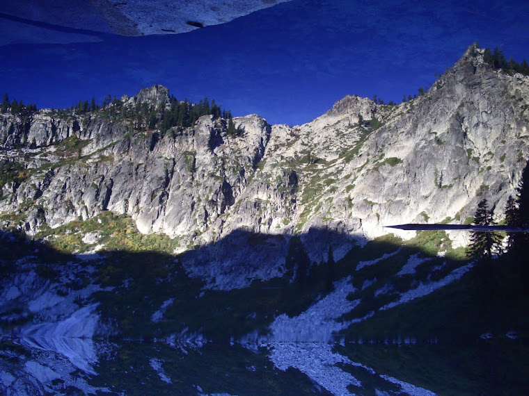
After lunch and a good dose of God's creation in all it's glory I headed back down to life in the valley. Along the way the clouds lifted on the surrounding mountains and I was able to shoot a couple of pictures of the Castle Crags dome. 


Looking south

Castle dome

The crags
 The hike out was easy and all down hill. I got back to the parking lot just as the sun was setting. The clouds were giving off a rainbow affect that was just amazing. The picture does not do it justice.
You can see some color in the lower right portion of the picture

The road home
 As much as I enjoy my travels the road home to my family is the best trip I take.
Thank you once again for joining me on my journey into the wilderness. I hope this will encourage anyone who reads this to take a trip themselves and experience the the world we live in in an intimate way that can only be had by putting your feet to the dirt (or snow) and stepping away from society and into the wild.

Saturday, November 20, 2010

Castle lake

11/18/2010
This last Thursday I took a trip out to Castle Lake. It is one of my favorites places to go any time of the year. My plan was to climb to the top of the ridge (red arrow) and work my way across to the high point, which in this picture is behind the tree (green arrow).

This picture was taken a couple of summers ago
This picture shows the ridge better. My destination was black arrow.


When I arrived at the parking lot I realized that the weather was not working with me and I would have to adjust my plans. I did not want to try a cross country trip when the visibility was only a couple hundred feet.
I went with my backup plan which was to take the trail up over the ridge and visit a couple of lakes. I had never been to Little Castle Lake so that was my first goal.
This was taken from the same location as the pictures above.
     The wind was blowing a good 20mph and it had just started to rain. No point in letting a little wind and rain ruin the day so I loaded my gear and headed out. As I hit the trail the rain started turning to snow and the wind picked up a little bit. I consider this a mixed blessing. I will stay drier with the snow but the wind was driving it straight into my face.
     Normally when I go hiking the terrain is the primary experience. Today it was the weather. 
The sound of the wind in the trees was a constant companion throughout my trip. It is such a primal sound. I took more than one break to just stand and listen as the gusts of wind rushed through the forest around me. I don't think I will ever get tired of listening to the wind. The fog/clouds completely changed the landscape. Normally once you start climbing out of the valley the view just keeps expanding and you can see for miles once you reach the ridge line.
view to the north on a beautiful summer day
Not today
This was the most I saw of the lake all day
The trail heads south and climbs along the ridge on the east side of the lake. It is a steady climb but not but not overly so. Once you crest the ridge there is a small pond.

Pond on a clear day
Pond on a not so clear day
Once I topped out on the ridge the wind really picked up. The trail works it's way around the left side of the pond (red arrow) and then heads down the other side of the ridge towards little castle lake(blue arrow). once I dropped down off the ridge the wind was much more manageable.

After spending a few minutes with my map program I realized I could add selections  to my posts which allow for much better clarity on exactly where I am talking about.

The trail heads out past the pond through a large stand of trees and then down it goes.


This is steeper than it looks.
I had not been much farther on the trail than this in the past which made this section of the hike that much more of an adventure. The trail continued to drop for a while and then leveled out into a meadow. I located the side trail and made my way to Little Castle lake.

The meadow was very brown but I am sure during the spring it is quite beautiful.
This was all I could see of the lake
Grass surrounding the lake
After spending some time at the lake and finding a very nice camp site I headed back up to the ridge top.

This was the trail leading out of the camp sight I mentioned

Took a break at the top of the ridge near the pond.

The weather was not getting any worse and the cold was not affecting me yet so I decided to look for a side trail that would take me to heart lake. I was not willing to try a cross county attempt without at least some kind of trail to navigate by. I located a trail just North West of the pond that seemed to be going in the right direction. So I gave it a shot. Just to be on the safe side I went old school and used stacked rocks to mark the less clear sections of the trail. It was worth the effort. On the way back I needed to use them a couple of times. On the way to the lake I head a very distinct noise that I could not identify at first. After a little investigation I discovered that it was the snow striking the bushes around me. It was a very pleasant sound.

Looking back towards Castle Lake on the way to Heart Lake

Last hill before the lake

The terrain has a very surreal look to it. 

The trees are bent I am guessing because of the snow load during the winter pushing them down towards the lake.

Took another break here to eat and take some pictures of the lake

The blending of the light  and dark sections of the lake made for an awesome view.
Makes feel cold just looking at it.

No words. Wow
CLIF Bar promo shot. Still no endorsement offer. I don't know what they are waiting for.

The snow is starting to stick


My experience at Heart lake made the whole trip worth it. It was absolutely gorgeous. The lake was frozen and had a two tone look to it. It  was dark near the edge and brilliant white in the center from the new snow. When I first came over the ridge and saw the lake it was disorienting. Everything blended together and it was hard to sort it out until I walked down to the lake and got a better view. I stayed for a while and ate some snacks. While I was eating the snow started to really stick and it was coming down harder. With the trail being mostly rock I decide to head out before it got to slippery. This is not the type of weather you want to sprain an ankle or twist a knee.

Snow really starting to stick
I took this shot because I liked how the red in the rocks contrasted with the fog and the snow.

Just thought this look cool.

Back at the truck
The hike back to the truck was uneventful. The trail was just starting to get slick so I made the right choice in heading back when I did. In a few months I hope to snowshoe some of these same areas. Due to avalanche danger some areas will be off  limits but I should be able to retrace most of this trip. I hope you enjoyed the journey with me. If all goes well I will have another trip to share next month if not sooner.

Final comment: On the drive down the hill I had a very black. Very large bear cross the road about 100 yards in front of me. There was no time to get my camera so no pictures. It is amazing and sobering to see just how fast a bear can move. What a way to end this trip.